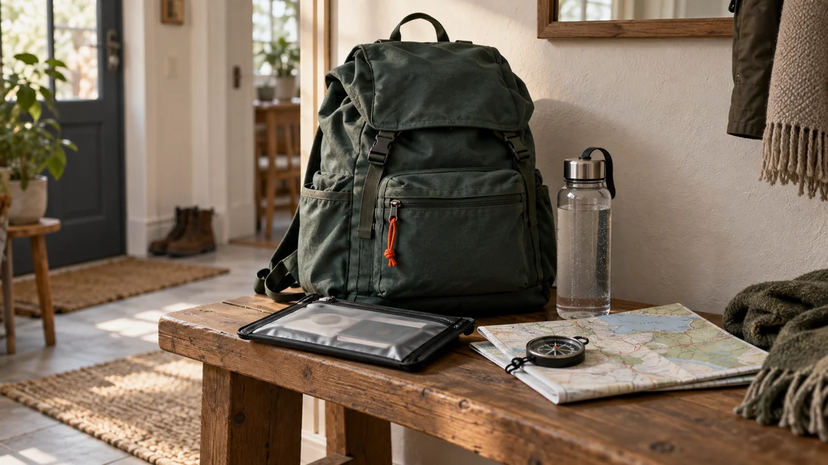
Your compass does not point north.
It points at the magnetic field, which near Seattle sits almost fifteen degrees east of the north your map is drawn to, and near Portland, Maine, almost fifteen degrees west of it. That is the first thing anyone who wants to navigate without GPS in this country has to absorb, and it is the thing that articles written for smaller continents quietly skip, because where they were written the correction is small enough to ignore.
The second thing is that the phrase covers two problems that have almost nothing to do with each other. One happens on a trail, on a Saturday, with three hours of light left. The other happens on a Tuesday night in your own town, with the power out, the cell network saturated, and a route you are supposed to drive that your phone has never heard of.
Same words. Different equipment, different arithmetic, different failure.
To navigate without GPS, first decide which problem you have
On the trail, the usual version is small and fixable. The path forked in a logged unit, the blazes stopped, you followed the group. You have a map; what you have lost is your dot on it. Nothing about your situation is dangerous yet, and it stays that way for as long as you stop walking.
The town version is stranger, because you are not lost at all. You know exactly where you are. What you have lost is the route — which roads are open, which bridge is under water, where the shelter actually is, and which of the four ways out of the county the sheriff has just closed. Your phone will happily show you a map right up until the tower’s battery runs down, and then it shows you a gray grid.
A third case exists, and it is really a consequence of the other two: no map, no compass, no direction you trust, a dead handset. That one is solved the night before. On the day it stops being navigation and becomes a stop-and-signal problem.
The common thread is the handset. A phone’s GPS chip works without any network — it listens to satellites, not to towers — but the map tiles it draws on usually do not, and a phone hunting for a signal it cannot find burns through its battery at roughly twice the normal rate. So the phone works, until the moment it is the only thing you have, which is the moment it stops. The wider version of that lesson, hour by hour, is in the extended power outage guide.
The paper map: USGS quadrangles, and the sheet for the road
The USGS has been the country’s civilian mapping agency since 1879, and its 1:24,000 sheets — the 7.5-minute quadrangles — are what it calls its most well-known maps. One inch on that sheet is 2,000 feet on the ground. Switchbacks are visible. Individual drainages are visible. It is fine enough to be useful and coarse enough that a single sheet covers a day’s walking.
What makes it a topographic map rather than a road map is the contour lines. The USGS puts it plainly: “The distinctive characteristic of a topographic map is the use of elevation contour lines to show the shape of the Earth’s surface”, and the spacing tells you the steepness — “In steep mountainous areas, contours are closely spaced; in flatter areas, they are far apart.” Lines crowded together are a headwall. Lines that open out are a bench where you can sit down.
Getting the sheet costs nothing. USGS offers free and immediate downloads through topoView, which it describes as “the largest selection of digital options,” and through The National Map Download Client. Paper is the other half of the sentence on that same page: “The online USGS Store is the only site for ordering paper topographic maps.” So you either print your own on a home printer, or you buy the folded sheet.
Either way it goes in a sleeve. Paper that gets rained on tears at the first refold, and a map torn along the crease you needed is worse than no map because you will keep trying to use it. A clear waterproof map caseaff. costs about what a sandwich costs and doubles as the thing you write on with a grease pencil.
The map the quadrangle does not replace
A quadrangle is drawn from a national database. It is accurate about the land and often silent about the trail system: numbers, junctions, which spur is maintained, where the seasonal gate is. For a specific national forest or park, the printed trail map sold at the ranger station reads better on the day, because a human who works there decided what to label.
Carry both if the area is new to you. A waterproof printed trail map for your national forestaff. folds into a hip pocket and survives a season of being sat on, which is more than can be said for a home-printed sheet.
Declination: the correction an American article cannot skip
NOAA’s definition is one line: declination is “the angle between magnetic north and true north”, positive when the needle sits east of true and negative when it sits west. Your map’s grid is drawn to true north. Your needle is not. The gap is a fixed, knowable number for your location, and in North America it is big enough to walk you past everything you were aiming at.
The figures below come from NOAA’s own calculator rather than from memory, because this is the kind of number that gets copied wrong from article to article for a decade.
The tool below turns that into your own number: pick the city nearest you, pick how far you would walk on one bearing, and it draws the two lines at the true angle.
Declination — the correction that changes with your address
How far off does an uncorrected compass put you?
Pick the city nearest you, then pick how far you would walk on one bearing. The drawing below is to angle: the dashed line is where you meant to go, the solid one is where the needle actually takes you if nobody corrected anything.
Distance walked on one bearing
Choose a city to draw the angle.
Setting it once, and the version that fails
Setting it is a thirty-second job at the kitchen table. A compass with a declination scale has a small screw that rotates the orienting arrow away from the housing’s north; you set it once for your region and then read bearings straight off the map with no arithmetic at all. A compass without that screw makes you do the sum every single time, and the sum is: add west, subtract east. In Maine you add 14.5 to the map bearing. In Seattle you subtract 14.9.
That is the version that fails. Not because the arithmetic is hard, but because at 4:40 in the afternoon, cold, you will do it backwards and be off by twice the declination instead of zero. Buy the screw.
Where the model stops being true
Declination is computed from a global model, and models are smooth. The ground is not. NOAA’s own FAQ warns that “local magnetic anomalies exceeding 10 degrees of declination, although rare, do exist”, and gives an example that should retire anyone’s faith in a single reading: “One area in Minnesota has a mapped anomalous area of 16 degrees east declination with anomalies a few miles away of 12 degrees west!”
Iron-bearing rock does that. So does the tailgate of your truck, the magnetic clasp on a phone case, a belt buckle, the trekking pole in your other hand. Hold the compass flat, at chest height, an arm’s length from metal, and read it twice. If the two readings disagree by more than a couple of degrees, something near you is wrong, not the field.
Taking a bearing, and taking it back
Three motions, and they are the whole of compass work.
Orient the map. Lay it flat, put the compass on it with the baseplate’s edge along a north–south grid line, and turn the whole map — not the compass — until the needle settles into the orienting arrow. The paper now matches the ground. Ridges on the sheet run the way ridges in front of you run. Half of all map confusion dies at this step.
Take a bearing. Point the direction-of-travel arrow at the thing you want. Turn the housing until its north lines sit under the red end of the needle. Read the number at the index. That is your bearing to that object.
Take it back. Add 180 if the number is under 180; subtract 180 if it is over. That is the back bearing, and it does two jobs. It is how you come home — a cabin reached on 240 is left on 60. And it is how you find yourself: sight a named summit at 300 degrees, draw the 120-degree line back from that summit on the map, and you are somewhere along it. Do that with a second landmark and the two lines cross on your position. A third makes a small triangle, and you are inside it.
Drawing those lines accurately is where a straight edge with a real scale on it earns its keep, because a bearing plotted freehand is a bearing plotted to the nearest five degrees. A UTM grid reader and map scale ruleraff. weighs nothing, clips to the compass lanyard, and reads 1:24,000 without converting anything.
One piece of honesty about the object itself: a round keychain compass sights nothing, and the compass app on your phone cannot be laid on paper to orient it. The baseplate is the whole point. Everything above is a geometry problem solved by putting a transparent ruler with a rotating protractor on a drawing, which is exactly what a baseplate compass is.
Terrain association: the skill that gets used instead
Here is the uncomfortable part. Almost nobody who navigates well is doing trigonometry out there. They are doing terrain association — reading the shape of the land against the shape on the paper, continuously, and noticing the moment the two stop agreeing.
It works on three ideas.
Handrails. A long feature running roughly your direction that you can follow without thinking: a creek, a fence line, a ridge crest, a powerline cut. You are not navigating, you are following something.
Catch lines. A long feature running across your direction that you cannot miss. You never aim for the trailhead, because a trailhead is a point and a point is something you walk past two hundred feet to the north and never see. You aim for the forest road the trailhead sits on — three miles long, straight across your path, impossible to cross without noticing.
Aiming off. Deliberately aim to one side of where you want to end up. Hit the road knowing the lot is to your right, and turn right. Aim straight at it and you reach the road with no idea which way to go — a fifty-fifty guess followed by a mile the wrong way.
The other half of it is the clock and the contour. You know roughly how fast you walk on the flat, you know climbing costs you badly, and you count the contours you cross. Cross eight when the map said three and you are not where you think you are. That mismatch is the alarm, and it goes off twenty minutes before “I am lost” does — if you were checking.
Checking requires seeing. Once the light drops below the tree line, terrain association stops working long before your legs do, which is why a light is navigation equipment rather than comfort. An LED headlamp with a red modeaff. leaves both hands free for map and compass and spares the night vision you need to read a skyline. A phone flashlight does neither, and spends the battery you are keeping for the call.
The town with no network, and the sheet in the glovebox
Switch problems. The power has been out since the afternoon, the alert on your phone says to leave by a route with a number on it, and the network is carrying four counties’ worth of people all trying to look at the same thing.
This is not a compass problem. It is a coverage problem, solved by owning the right piece of paper before the night it matters. Ready.gov puts “Local maps” on the fourteen-line basic disaster supplies kit for exactly this, between the manual can opener and the cell phone charger — an unglamorous line that the 72 hour kit checklist walks through in detail.
What “local maps” means once you buy one
In practice: a state atlas and gazetteer for the region, plus a county road sheet, plus your own pencil marks. Two routes out, drawn beforehand. The agreed meeting point circled. The out-of-area contact’s number written in a margin. A state atlas and gazetteeraff. is the single most useful map object for an American household, because it shows the back roads at a scale you can drive from and it covers the whole state rather than one quadrangle.
The instruction itself does not come from the map. It arrives over Wireless Emergency Alerts while the phone lives, and over NOAA Weather Radio and local AM after it does not — the argument made properly in the emergency weather radio guide. Map plus a hand-crank NOAA and AM receiveraff. is the pair; either alone is half a system.
Which map lives where is part of a larger question about what your address is actually exposed to, and that starts at natural disaster preparedness rather than in a gear aisle. The bag that carries all of it is the go bag, and the reason three days is the unit everything gets sized to is argued out in why 72 hours.
The habits that beat the equipment
Every search-and-rescue callout has the same two lines missing from the front of it: nobody knew where they were going, and nobody had agreed on a time.
The National Park Service’s Ten Essentials lead with navigation — “Map, compass, and GPS system” — and the trip-planning line next to them is the one that actually saves people: “Be sure to tell someone where you’re going and when to expect you back.” Free. Takes ninety seconds. Determines whether anyone starts looking tonight or Sunday afternoon.
Three habits, in order of how much they are worth.
Tell one person, in writing. Not “going hiking.” The trailhead, the route, the vehicle, and the hour at which they should start making calls. A text message works; a card on the dashboard works better, because that is what a ranger reads when the lot is empty at ten o’clock and one car is still there.
Note the trailhead when you leave it. Which road, which side, what the gate looked like, what time. Photograph the trailhead sign. On the way back this is the thing that resolves the last hundred yards of confusion, and it is free.
Fix the turnaround hour before you start. Not the destination — the hour. Sunset for that spot, minus an hour of margin, and split what remains in half.
Trip plan — five lines, one clock
Write the card you leave behind
Fill these in and the card writes itself, with the turnaround time already worked out from the daylight you actually have. Copy it onto paper, text it to one person, and leave a second copy on the dashboard. Nothing you type here is sent anywhere.
The card that comes out of it is worth copying onto paper, and paper that survives a pocket is a particular kind of paper: an all-weather notebookaff. takes rain and a wet glove where a printout turns to pulp. A pencil also writes on a wet page, where a ballpoint refuses.
What I would put in a pocket this weekend
Two objects and one text message.
The compass with the declination screw, set for where you live, and the map of wherever you are walking, in a sleeve. The text to one person, with the trailhead and the hour you will call. That is a complete system, and it fits in a jacket pocket.
The third object, if you want one, is not electronic either. Three blasts of a flat pealess whistleaff. carry further than a voice, keep carrying after your voice is gone, and weigh a fraction of an ounce on the sternum strap. It is the only piece of gear on this page whose job is to be found rather than to find.
A compass lives happily on a keyring next to the everyday carry essentials if it is a real one, and the whole inventory it belongs to is in the go bag checklist. The selection criteria for the rest — lights, radios, batteries — sit on the equipment page.
And the compass still does not point north. It points fourteen degrees off, in one direction on one coast and the other direction on the other, and it has done that the whole time you have owned it. The only question is whether the screw on the back of yours has been turned.
Frequently asked questions
- How do you navigate without GPS if your phone dies?
- With what you put in your pocket before you left: a paper map of the area and a baseplate compass. Orient the map so its north matches the needle, then find two things you can see and can also identify on the paper — a fire lookout, a water tower, a named summit. Take a bearing to each, add or subtract 180 degrees, and draw those two lines back from the landmarks. You are where they cross. With no map at all, pick a direction you trust and hold it until you hit something long and unmissable: a paved road, a creek, a power line. That is a catch line, and it works when a position does not.
- What map should you carry for hiking in the United States?
- The USGS 7.5-minute quadrangle at 1:24,000 is the standard sheet, and the USGS calls these the most well-known of its maps. At that scale an inch covers 2,000 feet, which is fine enough to see individual switchbacks and drainages. Download it free from topoView or The National Map, print it, and put it in a plastic sleeve. For a specific trail system, a printed waterproof map from the national forest or park often reads better because it shows the trail numbers and junctions the quadrangle does not name. Carry both if you are new to the area — they cost less together than a tank of gas.
- What is magnetic declination and do I need to correct for it?
- Declination is the angle between magnetic north, where the needle points, and true north, which is what your map is drawn to. NOAA defines it exactly that way, and in the United States it is large. The World Magnetic Model puts it near 14.9 degrees east at Seattle and 14.5 degrees west at Portland, Maine, for September 2026 — about 29 degrees of spread across the lower 48. Uncorrected, a 15-degree error throws you roughly 1,350 feet off for every mile walked. Yes, you correct it. Set the declination scale on the compass once, or add west and subtract east from every bearing you read off the map.
- How do you take a bearing and a back bearing?
- Point the baseplate's direction-of-travel arrow at the thing you want, then turn the housing until its north lines sit under the red end of the needle. The number at the index is your bearing. For the back bearing, add 180 if the number is under 180, subtract 180 if it is over. A cabin you reached on 240 degrees is left on 60 to come home. The same arithmetic is what lets you plot yourself on a map: you sight a summit at 300 degrees, you draw the 120-degree line back from that summit, and you are somewhere on it. Two landmarks give two lines and a position.
- Why keep a paper map in a go bag if the evacuation is by car?
- Because an evacuation is the exact moment the phone stops helping. Cell sites congest first and fail second, navigation apps route every car onto the same three roads, and the assigned evacuation route is frequently not the one the app likes. Ready.gov puts local maps on the basic disaster supplies kit list for that reason. A state atlas plus a county road sheet, with your meeting point and two routes drawn on in pencil, reads in a dark car with a headlamp and does not need a tower. It is the cheapest line in the whole bag.
- What should you do if you get lost on a trail?
- Stop walking. Almost every bad outcome starts with continuing to move while confused, downhill and in fading light. Sit down, drink, eat something, put on a layer before you are cold. Then work the problem: can you name two things you can see that are also on the map? Can you retrace to the last junction you are certain of? If the answer to both is no and daylight is going, the day is over — shelter where you are, make yourself visible and audible, and call 911 while you still have battery and bars. Walking in the dark on unfamiliar ground is what turns being late into being hurt.
- Does the sun-and-watch trick actually work?
- It gives you a rough direction, never a bearing. With an analog watch set to local solar time you point the hour hand at the sun, and the line halfway between it and twelve o'clock runs roughly south in the northern hemisphere. The problem is the clock: daylight saving time adds an hour, and sitting at the eastern or western edge of a time zone adds more. Uncorrected, the error runs to tens of degrees. That is enough to know which side the valley is on. It is not enough to hold a line through three miles of timber, which is what a two-ounce compass does without needing the sun at all.
- How do you set a turnaround time?
- Before you leave, from the sunset time for the actual trailhead rather than the city you drove from. Take the daylight between your start and sunset, subtract an hour of margin, split what is left in half, and that is the hour you turn around — whether or not you reached the thing you came for. The return leg is always slower: tired legs, colder air, junctions that look different from the other side. Setting the number in the parking lot is the point, because the same decision made four hours in gets made by someone who does not want to waste the four hours.
Who wrote this
Baptiste S.
Founder and writer · bs-media
I am not a firefighter, a paramedic or a survival instructor. I am someone who read his government's household preparedness guide cover to cover, lives where winter storms knock the power out every year, and decided to do the work properly: read the official guidance, run the numbers, compare the spec sheets, and write down what I wish I had found. This site sells neither fear nor bunkers. It explains what an ordinary household can put together in a weekend, and in what order.
- I start from official guidance — FEMA, Ready.gov, the National Weather Service, the CDC, the American Red Cross — and I link to it. If I have not checked it, I do not write it.
- No guns, no bunkers, no doomsday: this site prepares an ordinary household for three days, two weeks, a month.
- I say what is not worth buying, including the things that sell best in survival stores.
- On health, medication and electrical work, I defer to your doctor, your pharmacist or a licensed electrician. That is not my job.
Read next
Backpacking Water Filter vs Purifier: What Each Removes
Backpacking water filter: what a 0.1-micron membrane stops, what slips straight through, and which of six technologies fits your trip. The sizes, from the CDC.
Everyday Carry Essentials: The Five That Matter
Everyday carry essentials: the five items worth adding to your phone, keys and wallet, what each one weighs, and why the rest of EDC is a hobby. Build yours.
Go Bag Checklist: Every Item, Every Person
The go bag checklist, item by item and bag by bag: the household bag, one bag for each person, infants, prescriptions, pets, and the gear to leave at home.
72 Hour Kit Checklist: Every Line, Counted
The 72 hour kit checklist, counted for your own household: gallons, meals, lights, batteries, the seven lines people leave out, and where it all fits at home.